Centre of Wales
The Geographic Centre of Wales adventure was part of a joint campaign with The Boy in a tent, Max Woosey, aimed at getting everyone, particularly younger people, outdoors and exploring.
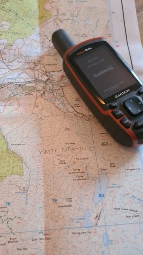
The Geographic Centre of Wales was determined by the British Ordinance Survey to be at:
- 52°:19.81318' N
- -003°:45.98453' W

If you were to cut the shape of Wales out on something like, say, cardboard, and try to balance that shape on a pin head, then the balance point would be the Geographical Centre - basically the centre of gravity.
The Geographic Centre of Wales
Max came to the public's notice by raising nearly £800,000 for [insert reason] by camping in his back garden [insert period]. At the time, Max's mother received online trolling from many who thought they were taking a risk allowing Max to camp out at night. And this trip was to also highlight that taking risks is part of a healthy lifestyle.
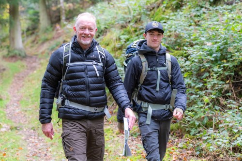
We met for the first time at a hotel in Devil's Bridge, just ar0ound 6 kilometres as the crow flies from the Geographic Centre of Wales. The initial plan was to walk to the centre, guesstimated to take around 3 to 3.5 hours, camp the night and record some media around the reason for the trip.
On the morning of the walk, a local photographer came to record the start for future social media and press releases. That took rather longer than expected but produced some nice photos...
In between we then recorded a piece for ITV Wales. All of which took more time.
Looking at the clock, we decided to start the walk from a car park at the Hafod Estate, much closer to the CoW. Good job that we did, because our estimates of time were way out and the walk from the hotel would have probably taken closer to six hours than three!
No plan, even our backup, survives contact with the enemy. in this case, the enemy came in the form of the Hafod Estate loggers. A big section of the forest we intended to walk through was deemed out of bounds due to the logging work. Thus, almost before we'd got underway, we had to re-route round the felling area.
After about an hour of impromptu orienteering, we emerged from the forestry into more regular farmland and started out climb up onto the moors where the Centre of Wales lay.
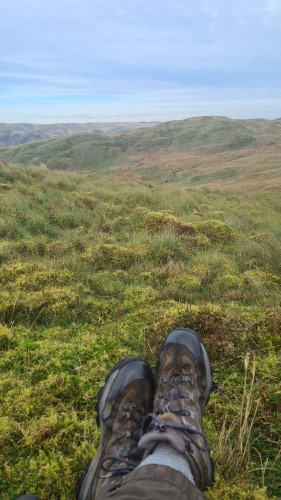
View at the Centre of Wales
Once on the moors we encountered a not-entirely unexpected barrage of bogs. Intense rain over the previous few days had made the ground sodden and this navigation of the bogs and reeds became a slow task. The only respite from wet feet came when we started the steep ascent to the target coordinates. Even though we'd spotted the climb from the contours of the map, reality seemed steeper than what we'd imagined.
As a result, the walk from the car park (more than halfway from the hotel) ended up taking nearly three hours in itself.
Anyway, Max and I reached the Centre of Wales at around 4pm, along with the rest of the party consisting of Mark Woosey, Max's dad, Simika Best and Emma Cantrill. Well done everyone because the trek had taken a considerable physical effort.
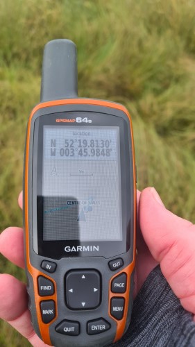
Coordinates of the Centre of Wales
Returning to the Hafod Estate was much easier. With the advantage of high ground we could spot, more easily, the dryer routes down the mountain and on to a farm track. Nevertheless, darkness was falling when we got back to the cars about 5 1/2 hours after we'd set off.